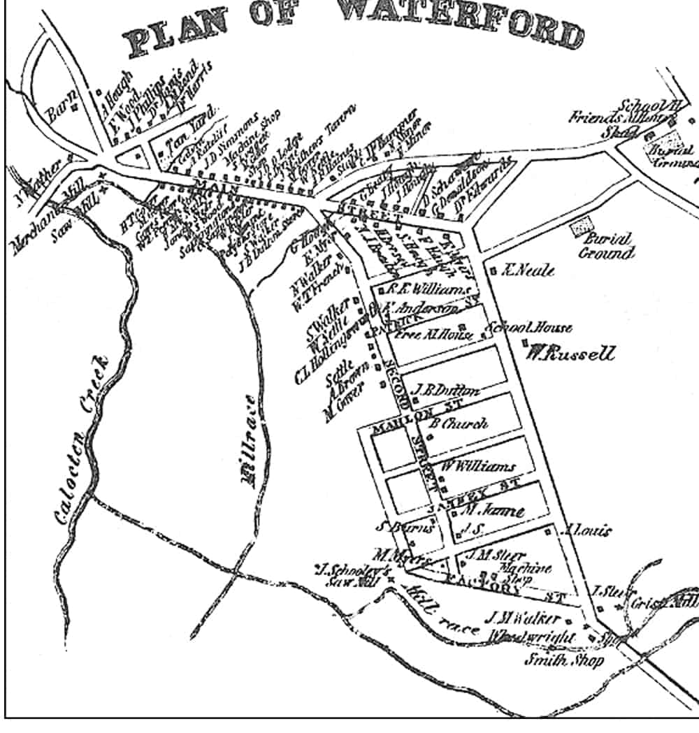
1854 Map of Waterford
More about the 1854 Yardley-Taylor map![]()
This map, adapted from an 1854 Loudoun County map by Quaker historian Yardley Taylor, shows the names of Waterford's residents and the location of streets, mills, businesses, churches, and burial grounds.